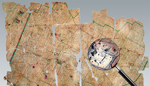
Cartography and Cadastral Maps
Italy
Cartography and Cadastral Maps
Visions from the past, for a vision of our future
6th November
Sala degli Stemmi
9.00 WelcomeDaniele Menozzi - Scuola Normale Superiore
Session I
Chair: Charles Farrugia – National Archive of Malta
9.15 András Sipos - Budapest Főváros Levéltára/ Budapest City ArchivesCadastral Maps – ideal field for international archival cooperation
9.30 Mario Signori – Archivio di Stato di MilanoIl portale tematico SAN Territori
10.00 Nicolas Verdier – CNRS UMR 8504 Géographicité, CNRS/Université Paris I Panthéon Sorbonne/Université Paris VII Denis DiderotThe visual aspects of surveys plans in France during the eighteenth century, between figuration of feudal rights and accurate map production
10.30 Andrew Janes - The National ArchivesCadastral mapping in a cadastre-less state: three major map surveys of England and Wales in The National Archives of the United Kingdom
11.00 coffe break
11.30 Enikő Török – National Archives of HungaryStep by step: digitisation projects of cadastral documents in the central archive of National Archives of Hungary
SÁndor Biszak - ARCANUM Ltd., HungaryDigitising,georeferencing and online publication of high resolution maps
12.15 Hannes Kulovits – Austrian State ArchiveOpening up historical maps
12.45 Lunch break
Session II
Chair: András Sipos - Budapest Főváros Levéltára/Budapest City Archives
14.30 Jay Osborn - Pamela Weisberger – Gesher Galicia (the bridge to Galicia) - The Cadastral Map & Landowner Records ProjectGesher Galicia's Cadastral Map & Landowner Records Project: A Virtual Recreation of a Vanished Province
15.15 Julian Holzapfl – Bavarian State ArchiveEarly aerial photographs from the State Archives of Bavaria - exploring a new synergy between archival holdings and geographic information
15.45 Harpal Dave - Centre for Environmental Planning and Technology University – IndiaAdministration of Land for Planning and Development - A case of Gujarat
16.15 Zviad Melkadze - National Archives of GeorgiaDigitalization of maps at National Archives of Georgia
7th November
Collegio Puteano
Session III
Chair : Beatrice Romiti – Sapienza, Università di Roma9.00 Umberto Sassoli - Maurizio Trevisani – Regione ToscanaTheprojectCASTORE- CAtastiSTOriciRegionali
9.30 Laura Giambastiani – Università di FirenzeEstimi and cadastral maps in the territory of Lucca in the period between the Ancient regime and the Napoleonic era
10.00 Liina Lõhmus - National Archives of EstoniaRegister of the maps in National Archives of Estonia: visions, plans, practices
10.30 coffe break
11.00 Mirjana Jurić - Croatian State Archives, ZagrebPresent and future of the digital cadastral heritage in Croatian State Archives
11.30 Biserka Budicin -Maja Cerić – State Archives in Pazin, CroatiaCadastral maps in the State Archives in Pazin and their usage in everyday archival practice
12.00 Alessandro Giacomello - Melania Zanetti - Scuola per la conservazione e il restauro dei beni culturali della Regione autonoma Friuli Venezia GiuliaPlans from the “Tavolare” cadastral system in Trieste: a historical heritage to preserve
12.30 Discussion
13.00 Lunch
Session IV - Young&indipendent researchers
Chair: Stella Montanari – SNS
14.30 Enrico Romiti – Università degli Studi de L’AquilaAncient cartography and historical maps, useful tools in the hands of the archaeologists
15.00 Santino Alessandro Cugno – Università di FirenzeLandscape Archaeology and Historical Cartography: the case study of ancient and medieval settlements in the territory of Canicattini Bagni
15.25 Paola Massa – Sapienza, Università di RomaCadastral records' ante litteram? Suggestions from the Catalogus Baronum and the confinationes of Southern Norman Italy notarial documents
15.45 The case of Lucca Tommaso Maria Rossi – Archivio Storico Diocesano di LuccaSources for Knowing the territory: The terrilogi in Historical Diocesan Archives of Lucca
Anna Antonia Martorano – Università di FirenzeMaps of the fund 'Acqua e Strade' of the State Archive of Lucca
16.20 Micaela Antola Illustrated cabrei, a private form of cadastral maps: the case of the Republic of Genoa
16.40 Vincenzo de Santi – Archivio di Stato di Trapani – Università degli Studi di MacerataOn-line access to the historical cartography of Trapani's territory: problems and perspectives
17.00 Alexandre Nobajas – University of KeeleFrom hidden to on-line, the case of Horta’s cadastral map perspectives
ENArC project – Scuola Normale SuperioreBenedetto BenedettiDaniele Menozzi
Scientific comitteeCharles Farrugia – National Archives of MaltaStella Montanari – Scuola Normale SuperioreBeatrice Romiti – Sapienza,Università di RomaAndrás Sipos - Budapest Főváros Levéltára/Budapest City Archives
OrganizationBarbara Allegranti – Scuola NormaleSante Lesti – Scuola NormaleStella Montanari – Scuola NormaleWith the cooperation of Giandonato Tartarelli